
Variety is the spice of life. Bicycle touring or “bike packing” was something I wanted to try for years. With a premier rail trail right in my backyard, it was time to stop putting it off and see what it was all about. I bike almost every day in the city, but an overnight trip on varied surfaces was new to me. Amy was practically brand new to cycling in general. My brother, Tyler, was the most experienced and completed a similar trip a few years ago with my dad. Were there better ways to spend my 30th birthday than biking hundreds of miles in the dog days of Summer? I doubt it.
Where: The Great Allegheny Passage from Pittsburgh, PA to Cumberland, MD and the C&O Canal Towpath from Cumberland, MD to Washington, D.C.
When: 6/29/26 – 7/4/26
Distance: 334 miles
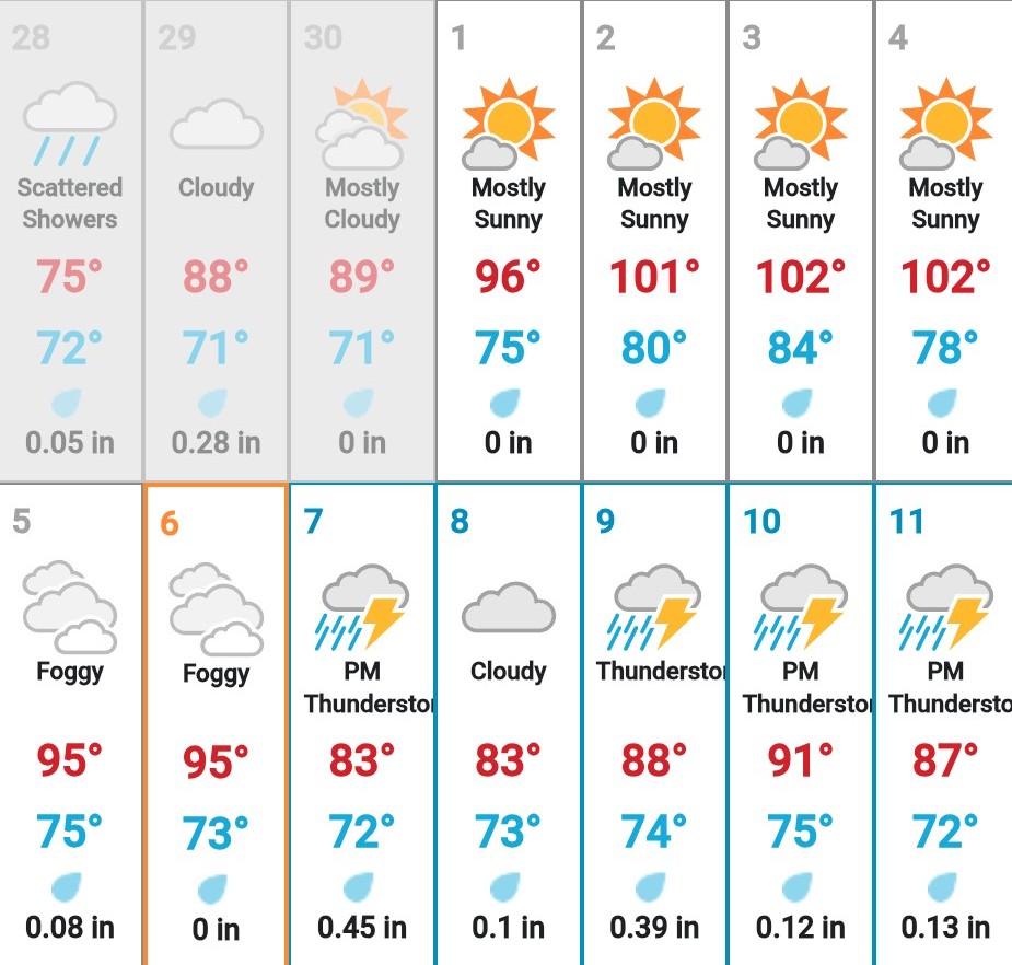
Conditions: Sunny, humid, hot
Pre-Trip Information
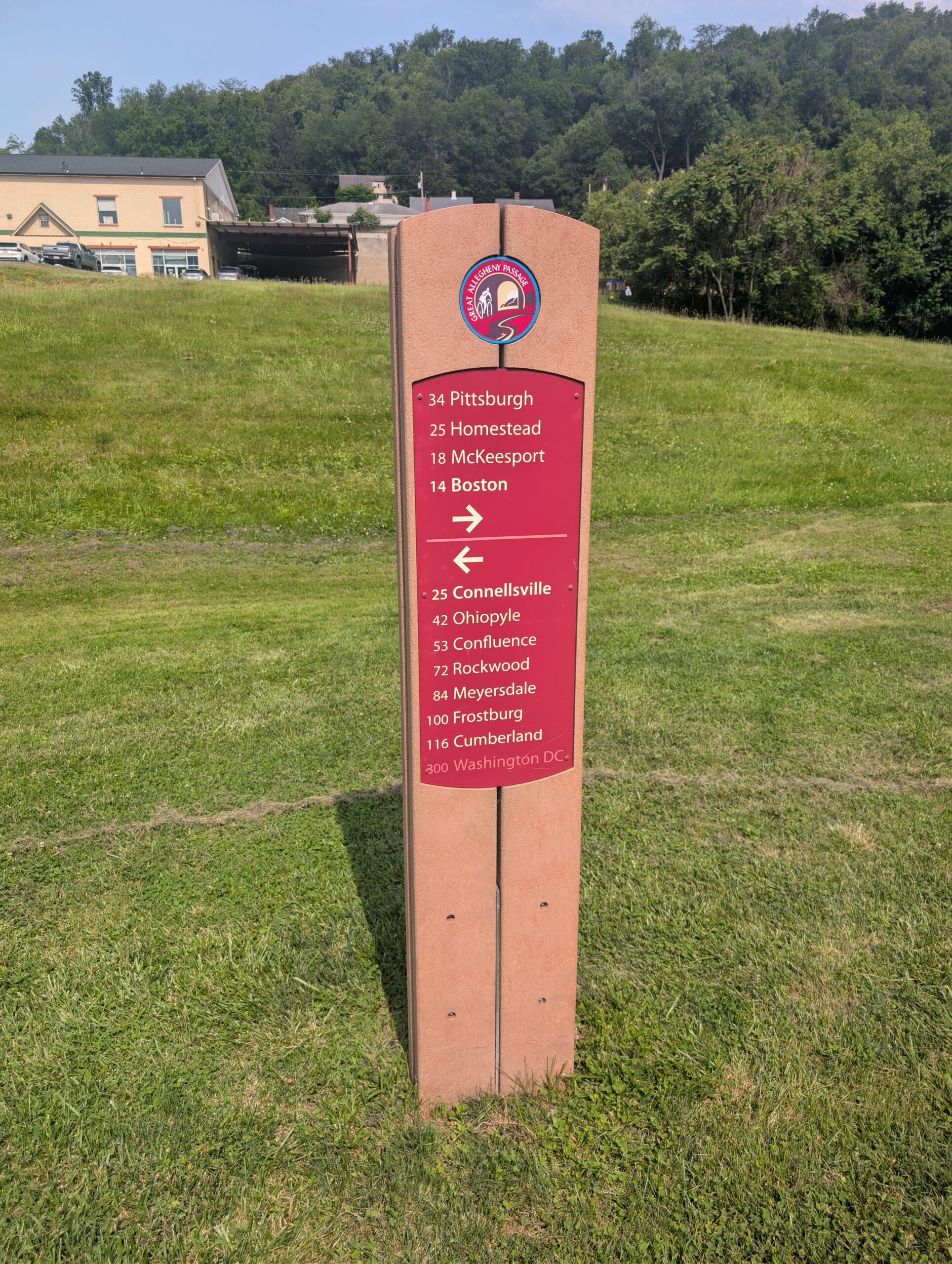
The Great Allegheny Passage is a 150 mile rail trail between Pittsburgh, PA and Cumberland, MD. It is primarily gravel and runs parallel to a few different rivers as it snakes its way southeast. It is one of the most highly regarded rail trails in the United States for several reasons:
- It is relatively flat the entire way. The steepest grade maxes out at 1.75%, during the ~25 miles between Cumberland and the Eastern Continental Divide. The other side of the divide is even flatter, maxing out at less than a 1% grade.
- The trail is wide and composed of smooth, crushed limestone for most of the way. The ~20 miles from Pittsburgh are paved. However, the gravel is so smooth that riding it is an improvement over the somewhat bumpy pavement.
- It is extremely accessible and passes through towns at least every 9 miles. It is technically possible to thru-ride without carrying much food or water and relying on towns the whole way. Camping is entirely optional and there are abundant hotels and B&Bs along the route.
- The trail is beautiful and offers a surprisingly diverse preview of western PA and MD. The meandering section along the Youghiogheny River is pretty and peaceful. Places like Ohiopyle State Park make excellent stops along the way. There is plenty of history to be found in the old, steel mill towns around Pittsburgh, PA and the train depots of places like Frostburg, MD.

The C&O Canal Towpath is a 184 mile towpath that runs along a canal built in the 1800s for transporting goods inland from Washington, DC to Cumberland, MD. It is an excellent bicycling trail for similar reasons:
- It is even flatter than the GAP, with only a few hundred feet of elevation changes between the two terminuses.
- The majority is along crushed limestone, but the surface sometimes switches to dirt. There are a few stretches of proper “singletrack” along the way (the roughest section is the ten miles east of the Paw Paw Tunnel). After rain I would imagine it could get muddy. Overall, however, I would consider the terrain accessible even to a first time gravel rider (me).
- There are regular towns along the way, though they are slightly less frequent than the GAP. It is still easy to exclusively plan for hotel stays. Campsites and water are more abundant on this trail.
- It is a scenic ride with regular views of the Potomac River. There is a ton of wildlife that lives in or around the canal. Highlights like Great Falls are absolutely stunning. The trail is loaded with interpretive history, canal lock houses, ferries, colonial towns, and the Civil War battlefield of Antietam.

The GAP and C&O Canal Towpath merge seamlessly in Cumberland, MD to form what is effectively one continuous route between Pittsburgh, PA and Washington, DC.
Gear
Pretty much any bike with gravel tires would be sufficient for these trails, but here is what I rode.
| Component | Make / Model | Specifications / Details |
|---|---|---|
| Frame | Specialized Sequoia Elite (Chromoly Steel) | 2018 Year / Size 58cm / 142×12 Rear Axle |
| Fork | Specialized Carbon Tapered | 100×12 Front Axle |
| Wheelset | HUNT 4Season Pro Disc | 700c / 1500 grams |
| Tires | Maxxis Ravager TLR | 700x50c / Tubeless Ready |
| Crankset | Shimano GRX 810 | 175mm length / 42T Chainring |
| Rear Derailleur | Shimano GRX 810 | 11-speed / Long Cage / Shadow RD+ Clutch |
| Chain | Shimano HG 701 | 11-speed |
| Shifters / Brakes | Shimano GRX 810 | Hydraulic Disc |
| Handlebar | PNW Components (Aluminum) | 480mm width / 20-degree flare / Drop bar |
| Stem | Alloy | 80mm length / 0-degree angle |
| Saddle | Ergon SR Allroad Men | |
| Frame Bag | Custom Made Frame Bags | |
| Pedals | OneUp Composite Flat Pedal | Flat |
| Lock | Kryptonite U-Lock | Cable |
| Rear Rack | Ortleib Quick Rack | |
| Panniers | Ortleib Gravel Panniers | QL2.2 / 29L volume |
| Stem Bag | REI Co-op Junction | |
| Bell | Spurcycle Raw | |
| Lights | Asher Bike Light Set |
I bought a used Specialized Sequoia a few months in advance in preparation for the ride. Most of the stock components have been upgraded. On my bike specifically, I appreciated the Shimano GRX 1×11 groupset. Since the trail was dry, 50cm tires were certainly overkill, but I am sure I would have appreciated them more if it was muddy.

I have custom frame bags that fit within the inner frame perfectly. These do not have much volume, but were a perfect place to store heavy electronics and everything related to bike-maintenance. This included a crankbrothers M19 multitool, a Cannondale Dirt Mini Pump, and two spare inner tubes (my tires and wheels are tubeless ready but I used tubes anyway for this trip).
The remainder of my gear resembled what I would carry on an average summer backpacking trip. The biggest difference was that I hauled everything in a pair of Ortleib QL2.2 Gravel Panniers hanging off an Ortleib Quick Rack. I was on the fence between using a saddle bag or going with panniers, and I am glad I chose panniers. They seem much more practical overall and I had even more capacity than needed with ~30L of volume (this is likely because I packed minimally with ultralight backpacking gear). The top of the rack was also the perfect place to haul my tent, a Zpacks Duplex with the freestanding flex kit. Tyler 3D printed some Voile straps for me to secure it in place, which worked wonderfully.

I did not track the rest of my gear too closely, however the following are some notable inclusions:
- Platypus Quickdraw water filter
- CNOC Vector 2L water bag
- King Camp synthetic blanket
- Exped Synmat Duo 3R sleeping pad
- Nitecore NB10000 battery
I dressed like a dirt bag and did not include spare biking outfits, partly because I assumed we would be able to do laundry regularly. I wore the same REI Sahara long sleeve button down shirt and Baleaf 4D padded bike shorts the entire time. A tighter fitting top may have been ideal, but I liked being able to vent with the buttons. It probably would have been smart to pack more chamois pants. Hygiene down there is extremely important and perhaps having a clean pair of shorts would have been better for the skin. I packed three pairs of socks and wore a generic pair of flat shoes that got pretty cut up from the spikes on my pedals. On my head was a Bontrager MIPS helmet.

Season
The Great Allegheny Passage and C&O Canal Towpath are ideal 3-season trails. I would at least wait for leaves to cover the trees in Spring. While high temperatures made it less comfortable, Summer is generally a great time to ride. Fall is the best season around here, and doing this journey as the leaves turn would be incredible.

Water
Both the GAP and the C&O Canal Towpath have abundant water sources along the route.
The GAP has potable water fountains on trail near the intersections of most towns. Each town also has several businesses (visitor centers, bike shops, restaurants, etc) with staff that are usually happy to fill up water for cyclists. Bathroom sinks are also an option. There is no need to carry more than a liter or two of water capacity on the GAP and a water filter is not needed.
The C&O Canal Towpath has fewer towns and no potable fountains. However, there are still abundant water sources via pumps available at each campsite. Car accessible campsites have potable well water treated with iodine. Every other campsite has non-potable, untreated water. To avoid the chemical taste and to have more options on where you can fill up, I would recommend bringing a water filter for this trail. One or two liters of capacity is sufficient.

Resupply
Towns with bike shops, restaurants, convienence stores and/or gas stations are regular occurrences along both trails. Rather than pack several days worth of food, consider just bringing a day’s worth of snacks, eating at towns along the way, and topping off your supply as needed.
Proper grocery stores are less common. Some of the towns outside of Pittsburgh, PA have Giant Eagles, as does West Newton, PA. Cumberland, MD has a Save A Lot not far off trail. Otherwise, most towns offer a market with selections similar to a gas station. Sheetz are common and always have an impressive snack assortment.

Transportation
Pittsburgh and Washington are connected via Amtrak’s Floridian line that runs nearly parallel to the rail trails the entire way. Bikes are able to be brought onboard, making this train the ideal transportation for the start or end of a thru-bike, in theory.

Unfortunately, our experience with Amtrak went off the rails. About 3 months in advance, Amy and I pre-booked two coach seats with bicycles from Washington to Pittsburgh (note: if you plan to bring bikes onboard you need to book as early as possible, as spots fill up quickly).
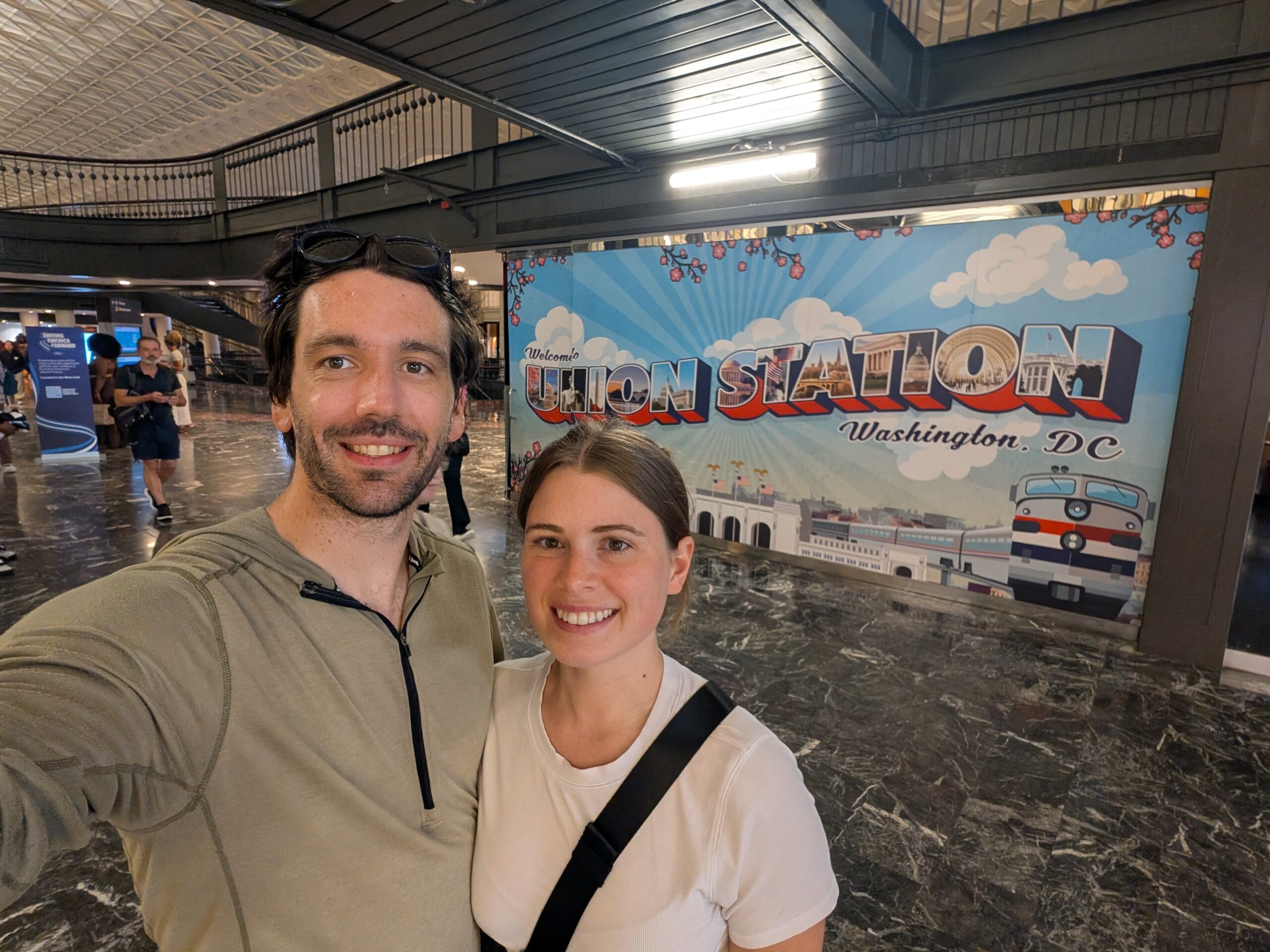
The train was scheduled to leave from Union Station in Washington at 3:57pm and scheduled to take about 7 hours to make the journey. There was an initial delay of 2 hours. After boarding, the train ride went fairly smooth until about midnight, when our train suddenly stopped and began moving backwards, returning to Connellsville station. We were given no updates for a while, then our conductor finally explained that a mudslide had made the track impassable. We sat overnight until 8:00am waiting for it to be cleared, during which time there was no communication about when we could expect to be home. We eventually arrived in Union Station in Pittsburgh around 10:00am, over 11 hours behind schedule. For comparison, we could have driven back-and-forth between the two cities nearly 3 times in the amount of time it took to go one way on Amtrak.
Tyler also had an Amtrak ticket booked to return home, (conveniently?) connected to Washington by the Carolinian line. His original train was straight up canceled just one day in advance. He instead had to leave a full day earlier then planned and the new train still had about 3 hours of delays. This is the state of US passenger rail.

Despite being borderline obsessed with trains, if I were to do this trip again, I would do everything I could to avoid dealing with Amtrak. Beyond the delays, the communication and customer service were dismal. The train carts themselves were quite comfortable, but it is not worth the time nor the money to experience them. There are several outfitters along the trails that advertise shuttle services. Consider contacting one of them to organize a return trip instead.
6/29 – Day 1
26 miles (+6) from Pittsburgh to Dravos Campsite
A few weeks prior, Tyler drove to Pittsburgh with his bike and left it at our house. He flew into the city at noon and we spent a few hours loading up our rides. At 5:00pm, we stepped out our door, walked down the stairs, then hopped on our bikes. Perhaps the greatest thing about our neighborhood, Lawrenceville, is its proximity to the north shore trail. The same 5 mile stretch of trail along the Allegheny River I have ridden dozens of times was the first leg of our journey to Point State Park.


The Point where the Allegheny and Monongahela rivers combine to form the Ohio River marks the western terminus of the GAP. I think the trail really ought to be officially re-routed over the Smithfield Bridge through Southside instead of the noisy stretch along the highway, but I digress. The Monongahela wharf is such a pleasant spot that I never grow tired of.

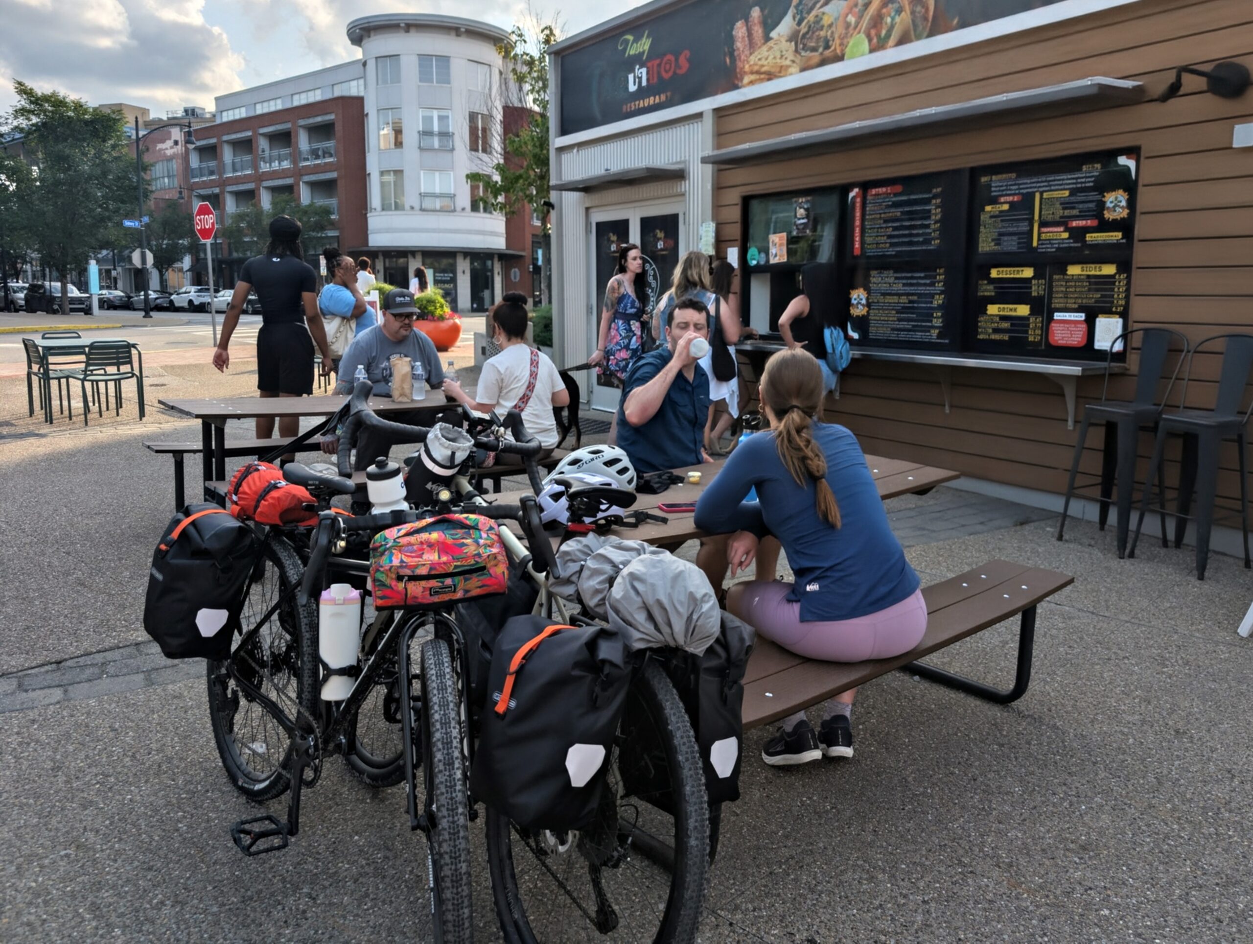
We crossed the Hot Metal Bridge and made a pit stop at REI for some last minute essentials, then grabbed tacos in the stand across the street. Now closer to 6:00pm, we still had over 20 miles to do, so we hit the trail fueled by burritos.
Shortly afterwards, Tyler’s rear rack came detached and the back of it fell down on the trail. Fortunately, nothing broke and it was easy to reattach. This event warranted a “shoosh” from Amy, some random phrase she has started saying every ten minutes and would continue doing so for the entire trip.

Once Tyler was fixed up, we got back to business and pedaled our way to Homestead. Next, we entered Mckeesport and reached the furthest Amy and I had been on the GAP. Up to this point, the trail was a mixture of smooth and lumpy pavement. This switched to crushed limestone and never really returned. This was also the point where the Youghiogheny River fed into the Monongahela. We turned off to follow the former for the next hundred miles or so.

It was a pleasant evening as the trail took us through a lengthy residential neighborhood. We blew past the small town of Boston and saw an ongoing youth baseball game featuring a team wearing mostly red: the Red Sox, I presumed.

Come dusk, we made our way through the whimsical forest illuminated by lightning bugs. Dravos Hiker-Biker Campsite was right off trail, where we pulled over to call it a night. This free campsite was entirely volunteer maintained and offered three lean-to shelters, a bathroom, potable water, and abundant firewood. I attempted a fire, but it was too damp to really get going. We claimed one of the shelters and fell asleep under the Strawberry Moon.

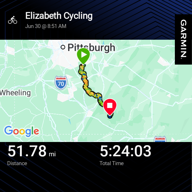
6/30 – Day 2
50 miles from Dravos Campsite to Ohiopyle
Amy and I are quite familiar with waking up and packing up backpacks. Panniers were just a bit different. We loaded up and were back on our bicycles by 9:00am.
Just a few miles from camp was the tiny town of Sutersville. Google directed us to a nondescript place called the Coffee Stop and I do not think we could have ever found it otherwise. There was no signage on the exterior of what seemed to be an average single-family home. Inside was a dining room surrounded by shelves of food, a small dog in a fish tank, a PA skill game, and plenty of clutter. Amy’s first questions to the nice woman who served us were “do you have espresso?” followed by, “do you have any vegan food?”

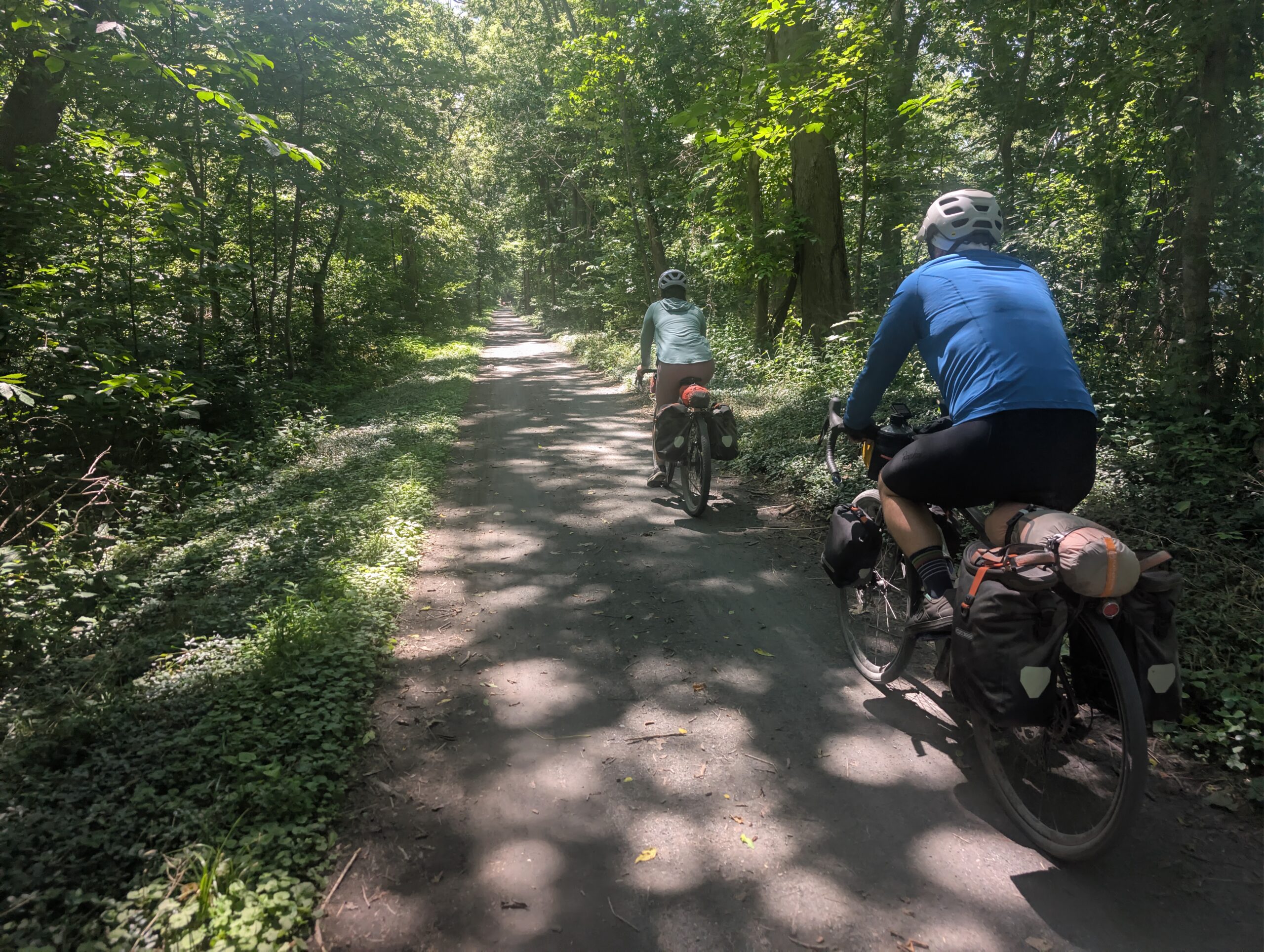
It was a strange dining experience, but we at least got some food in our belly’s and caffeine in our vein’s before hitting the trail. The buttery smooth limestone continued down the west bank of the Youghiogheny River. For most of the day, the GAP was wide enough for us to ride three bikes side-by-side. In this formation, Amy nearly ran over a black snake.
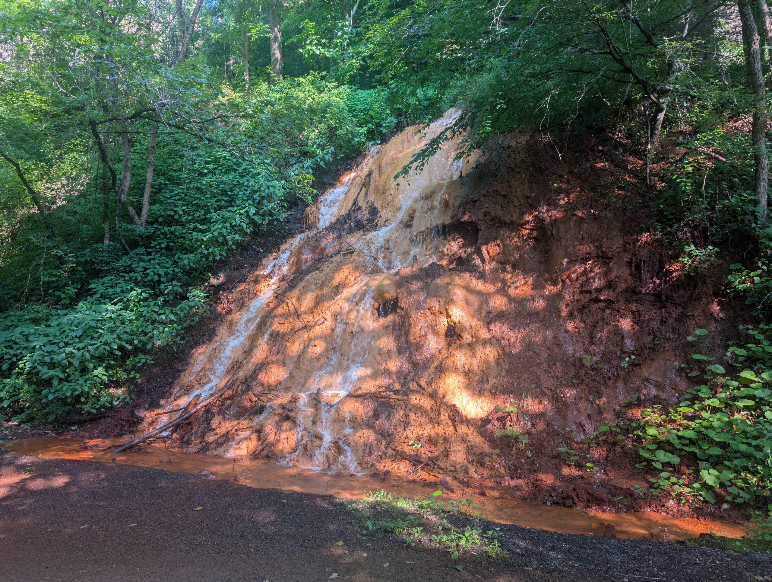
We crossed through the town of West Newton, which had a bike shop right off trail. We did not stop for long, and opted to take most of our breaks at the regular riverside benches. As the heat continued to rise, Amy loudly proclaimed, “I need to to take a dunk”. Tyler argued with us that a pretzel was a baked good, not a chip.

Moving right along, we cleared more residential trail leaving West Newton and entered the Ohiopyle region. This section was beautiful and offered thick tree coverage. However, this was also where the grade of the trail steepened to a modest 1% uphill. This sounds minor (and it is), but I could really feel the difference. Essentially, if you stopped pedaling at any point, you would slow to a halt in just a few seconds, which meant constant pedaling was needed to make progress. This grade would continue all the way to the Eastern Continental Divide, some 60 miles ahead.

We went through Connelsville, which welcomed its two-wheeled visitors with the Yough River Park. We pulled over for lunch at the first dining option, The River’s Edge, gladly opting for indoor seating with air-conditioning over the scenic patio. The food was decent and Tyler and I shared an ice-cold Yuengling. Before leaving, we made sure to fill up our water bottles at the restaurant.

The day continued past 50 miles, a daily distance record for both Amy and me that would not stand for long. We pedaled through the laurel highlands a dozen more miles or so before finally reaching Ohiopyle. I reserved a campsite at the bike-in campground right off the GAP, which saved us from having to climb the formidable hill to Kentucky Campground. This campsite was primitive and had no amenities, but we were just a ten minute ride into town anyway, so we went there after setting up our tents.

I think the town of Ohiopyle is really cool and has so much charm. Dinner was at the Twisted Spoke Cafe. The waitress told us that they had this beer called General Braddock on draft, brewed somewhere near Uniontown. That did not sound right, but Tyler and I took our chances and enjoyed one of Pittsburgh’s best IPAs as a reward for the long ride.

After eating, the consensus was clear: we all needed to take a dunk. The dust from riding gravel clings to sweat, so my legs felt had a distinct sandpaper texture that felt truly disgusting. The remedy was a dirtbag shower in the Youghiogheny River as the sun set over the mountains. Before heading back, we grabbed some ice cream from the Falls Market.
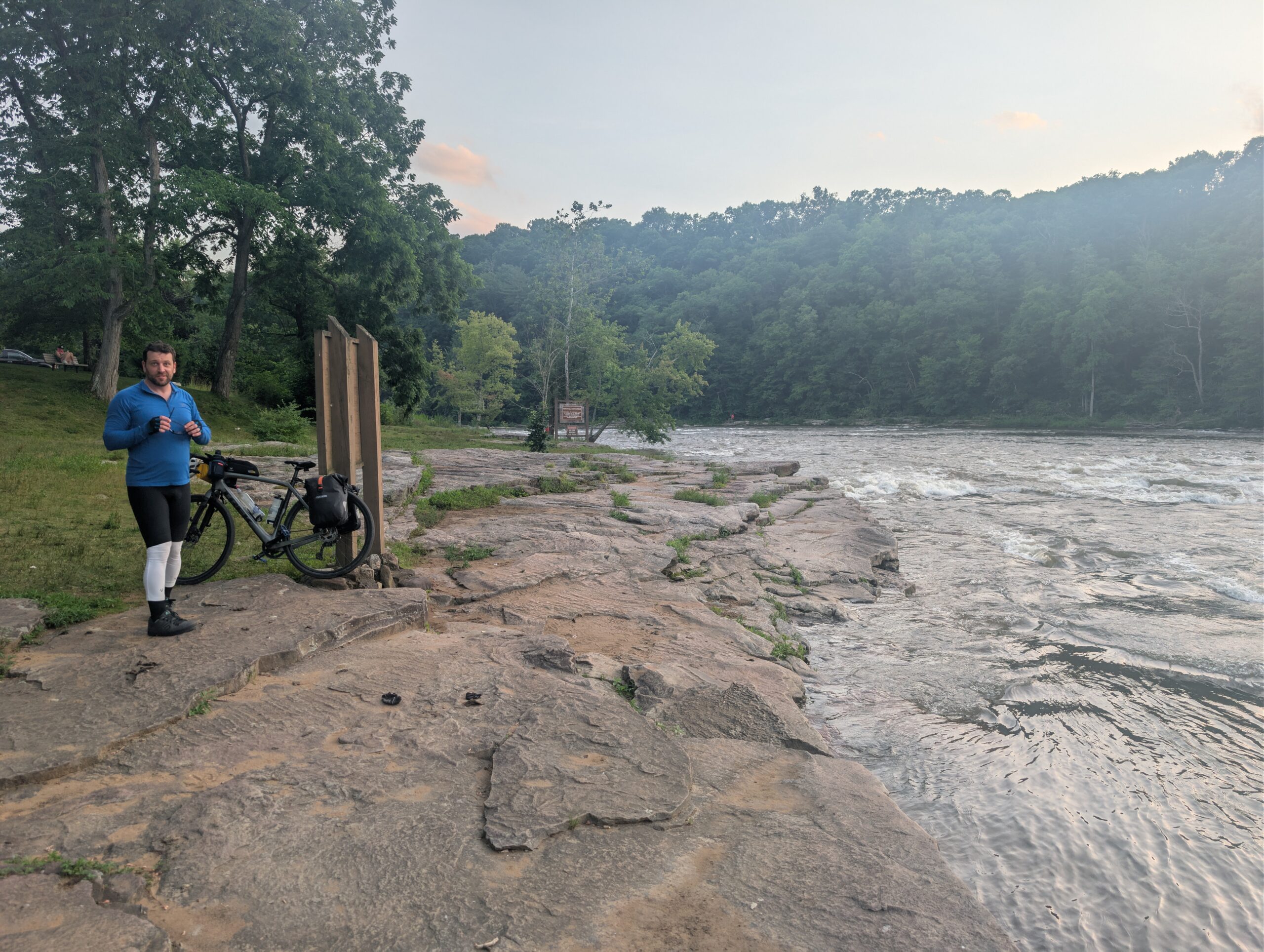
At camp, I immediately crawled into my tent and passed out within minutes. I woke up to Amy poking me a short while later, grumbled, and rolled over. Later, she woke me up again with even more urgency, “there is some animal outside!” I turned on my light and peered out towards our bike. A raccoon was rummaging through my pannier! I yelled and pounded the ground to scare it off, however it kept coming back even after I moved all the food inside our tent. Eventually, I pulled the panniers inside too and moved my bike away from the picnic table, which seemed to fix the problem. I am sure the pesky trash panda was still snooping around our campsite all night.

7/1 – Day 3
57 miles from Ohiopyle to Frostburg (Allegheny Trail House)
We slept in late this morning, blaming the coon for a restless night. By 9:00am, Amy and I were loaded up and sipping brews from Ohiopyle Coffee Company. We ate breakfast here, then made a quick pitstop at the Falls Market for water and snacks.
A group of four middle-aged men rolled up and asked us if we were going to D.C. for the 4th of July. “I dunno, not sure we will make it.” Their names were Brian, Nick, Jack, and Solomon and we would continue to run into them daily for the rest of the trip. They had a faster pace than us, but would take frequent breaks to piss out the excessive amount of Miller Lite they consumed.
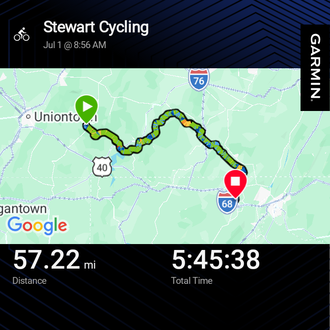

The section leaving Ohiopyle was fabulous. The green tunnel protected us from the worst of the sun’s rays, but it was still blisteringly hot. We came to a town called Confluence and began following the Casselman River. We made great time despite the steady uphill.

The town of Rockwood was next, featuring another bike shop right on trail, a visitor center, and a savory crepe cart. The four guys we previously met (henceforth referred to as the “frat bros”) were hanging out, along with an absurdly flexible man doing the trail on an e-bike. The frat bros explained that they met one another at the gym and became cycling friends. They ran into Soloman, who was from Ghana, while doing a weekend ride, and now they do a long bike trip once a year. Eventually, the conversation turned to the wonders of butt cream and I was convinced to start using anti-chafing lube for damage control.

We resumed our cycling and found ourselves in three-wide formation after a few miles. All of a sudden, a chipmunk darted in front of us, panicked, tried to turn around, but ran directly underneath my 50cm tire. Tyler and I stopped to move him off trail and hold a brief funeral.

We pedaled over an elevated wooden bridge overlooking rural Pennsylvania before reaching yet another town. The Meyersdale visitor center had a neat museum and sold us bomb pops. The frequent breaks were necessary, as the trail seemed to grow ever so slightly steeper as we neared the apex. The final eight mile push was partially exposed and very, very hot.

At last, an underpass marked the Eastern Continental Divide. At 2,392′, this was the highest point of both the GAP or the C&O Canal Towpath. There were no excuses now, as it was literally all downhill to Washington.


The proceeding 24 miles to Cumberland were graded at a cruisey, 1.75%. It was such a relief and we quickly realized we could have very easily completed the remainder of the GAP today, had we not pre-booked a hotel in Frostburg. That being said, the miles were not going anywhere. We first came upon a lovely Appalachian vista, then reached the Big Savage Tunnel. This 3,291′ long tunnel was well-lit and so much fun to rip through. Shortly after exiting, we crossed the Mason-Dixon line into Maryland.

In no time at all, we made it to the base of Frostburg, MD, which sits at the top of a big ol’ hill. An infamous series of loose gravel switchbacks brought us to the real challenge, Depot St, a steep road leading from the train station to downtown. We stayed the night at the Allegheny Trail House B&B.

We walked through town on a sidewalk which randomly departed from the road and went up and down a hill. Then, we ate dinner at El Maya Mexican Restaurant and watched team USA win a World Cup match against Bosnia. I really enjoyed the town of Frostburg and was glad we spent the evening there.

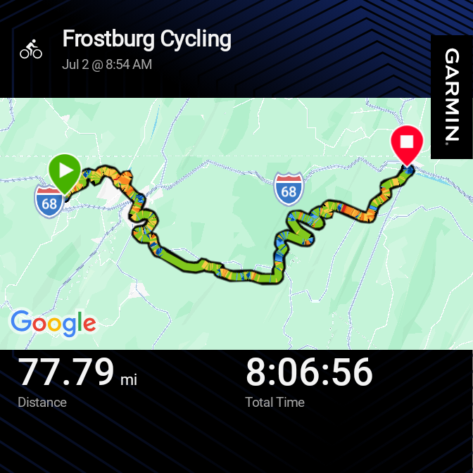
7/2 – Day 4
77 miles from Frostburg to Hancock (Super 8)
On my 29th birthday, I asked Amy if we could hike 29 miles on the PCT together. She said no. So today on my 30th, I decided to bike 30 miles two and half times! Jason, the owner of the B&B, was vegan and made us a delicious breakfast to start the day off right. We made casual conversation with a couple from Kentucky who were avid maple tree tappers.

We braved the Frostburg switchbacks once more, then continued our downhill journey. Pedaling was entirely optional and we pretty much took full advantage of that. This section was an absolute blast. Within two hours, we completed the 16 miles into Cumberland, MD and reached the end of the Great Allegheny Passage!

Cumberland is a nice town with interesting architecture and plenty of small businesses. We went to the Corner Tavern and Cafe for breakfast where I had some incredible avocado toast. There was a Save A Lot next door where we grabbed some additional snacks. By noon, we navigated back to town square where the C&O Canal Towpath led an additional 184 miles all the way to Washington, D.C.

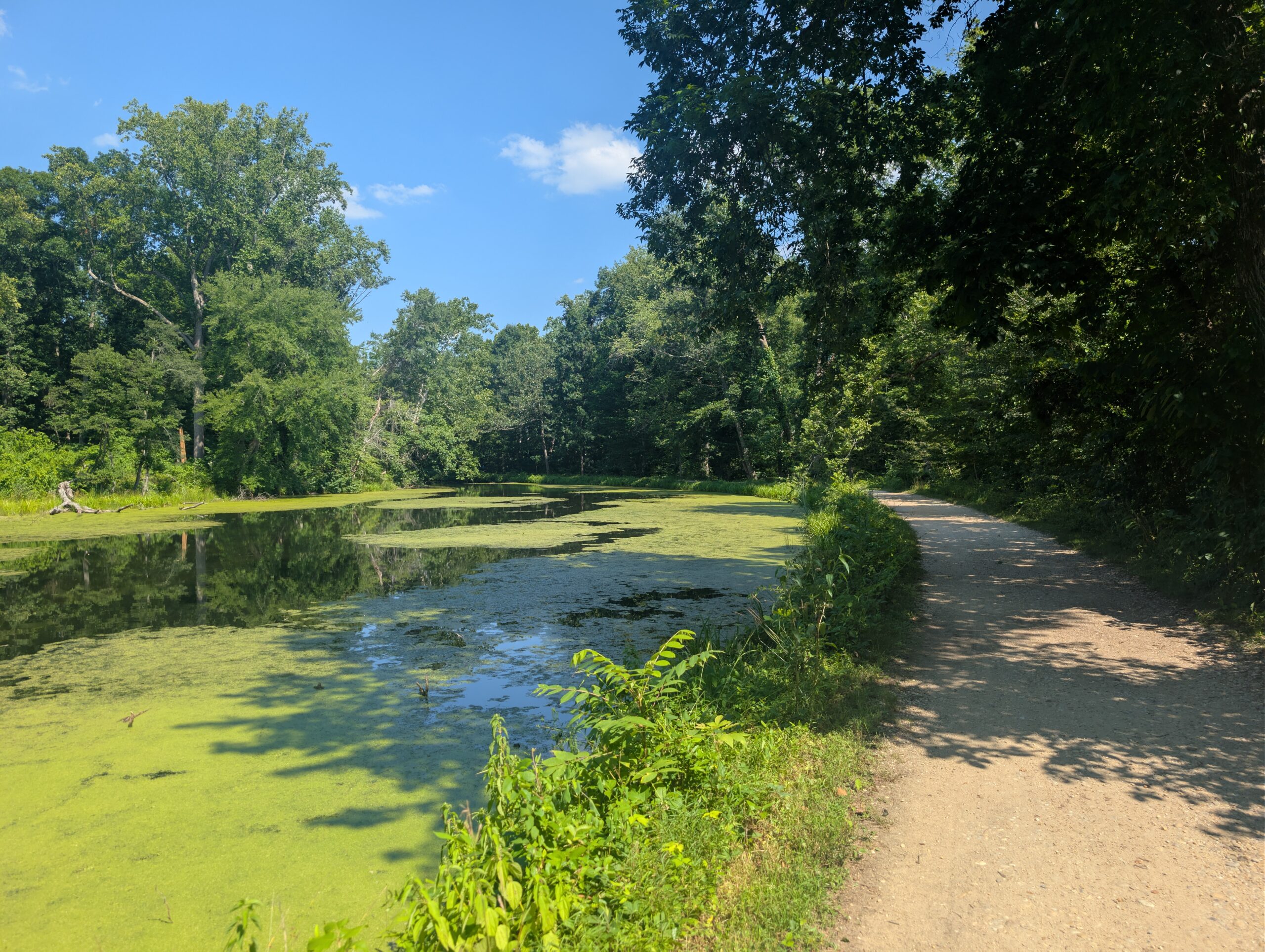
Unlike the GAP, which was a resurfaced rail trail, this trail followed a literal towpath that was used throughout the 1800s to tow cargo boats inland along a man-made canal. The canal would be to our left the entire way, alternating between various states of normal water, stagnant scum, and completely dry. To our right was the mighty Potomac River, notably wider than any of the other rivers we followed.

While the previous days were certainly toasty, today was the first day flirting with a high around 100 degrees. This was the start of a major heat wave sweeping the eastern US. Water clearings were now on either side of the towpath, so the trail was generally more exposed than the GAP and we were no longer protected by a dense tree tunnel. Hot, hot, hot!
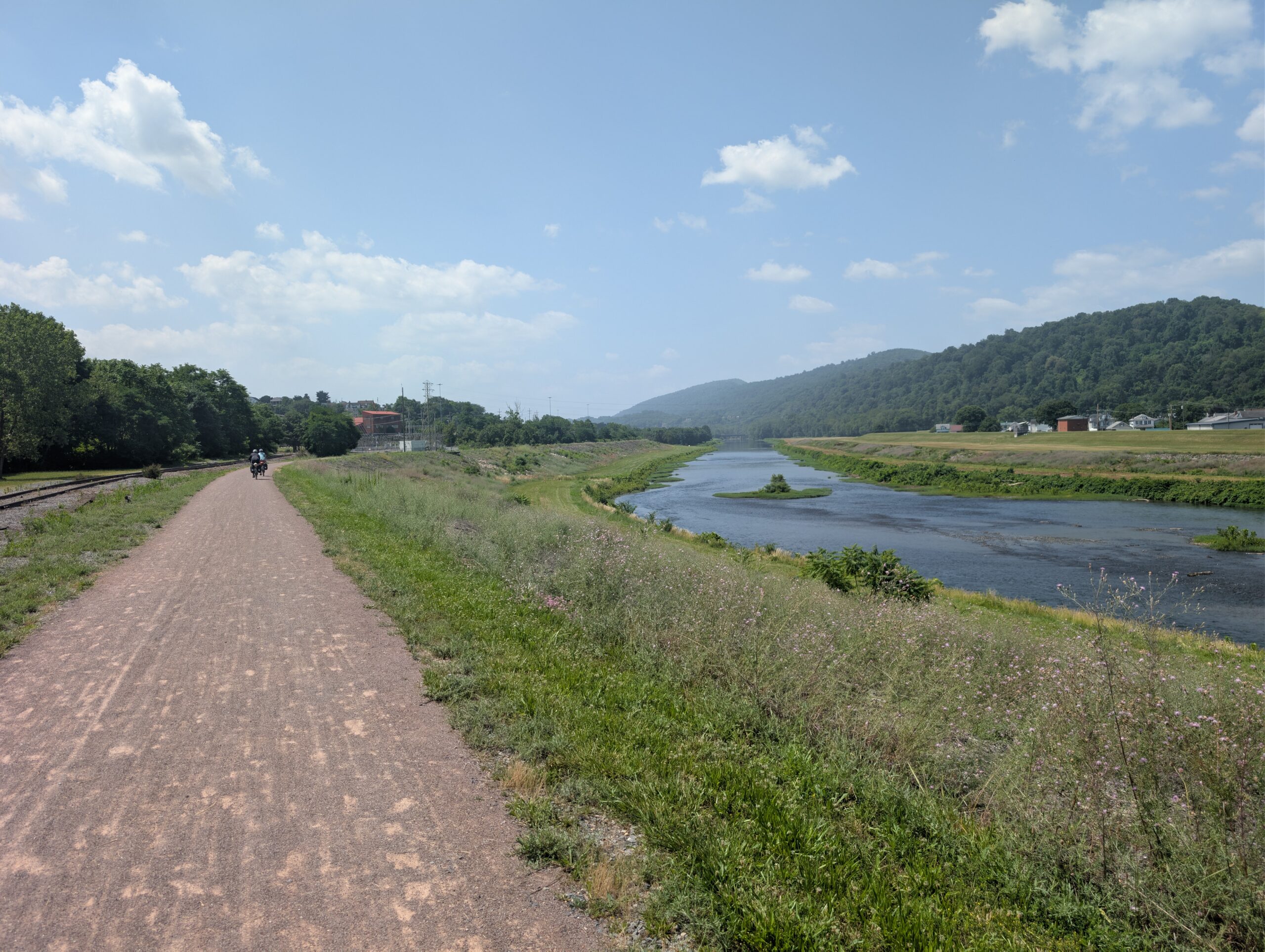
We could not possibly drink too much water. Gone were the potable faucets of the GAP. The C&O had regular campsites every 5-10 miles and every campsite had a water pump. Most of these were not potable and needed filtered, though car accessible sites had potable wells treated with iodine. We quickly learned to avoid these potable pumps, because iodine water tastes awful and we would much rather filter.
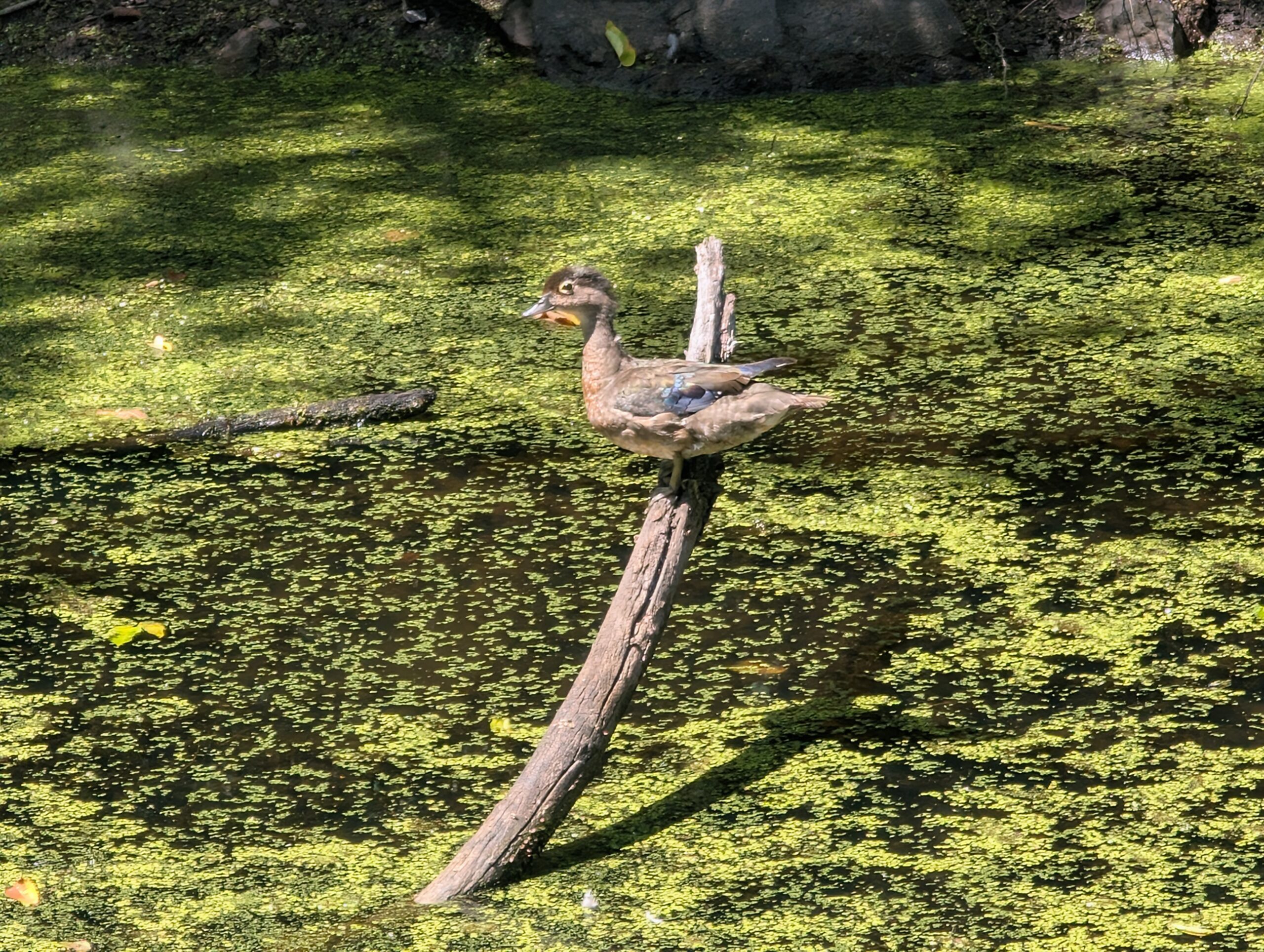
It was not long before we biked past the first lock house. These lock houses were built by the C&O company to be inhabited by lift operators, who worked the nearby lift locks at each location. Since water obviously cannot flow uphill, these lift locks were used to lift the cargo boats to the next stretch of canal. In total, 74 lift locks enabled cargo boats to conquer over 600′ of elevation gain during their journey. We would continue to pass a lock house every few miles for the entire C&O Canal Towpath.

We kept riding through the midsummer heat, stopping once to take a dunk in the Potomac River. Otherwise, the best relief was to pull over at every campsite and pump the cold well water on our heads. Amy was feeling a bit nauseous from the heat at one point, but managed to cool off after an extended break.

As far as the trail itself, the terrain was great and perfectly smooth. That is, until the tunnel…
Everyone was excited for the Paw Paw Tunnel; each of the previous tunnels had been unique and effectively air-conditioned. Someone even suggested we take a lunch break within. What we did not expect was a pitch black quarter mile of narrow, pothole-ridden sidewalk with a sketchy wooden fence as the only barrier between the dead waters of the canal.
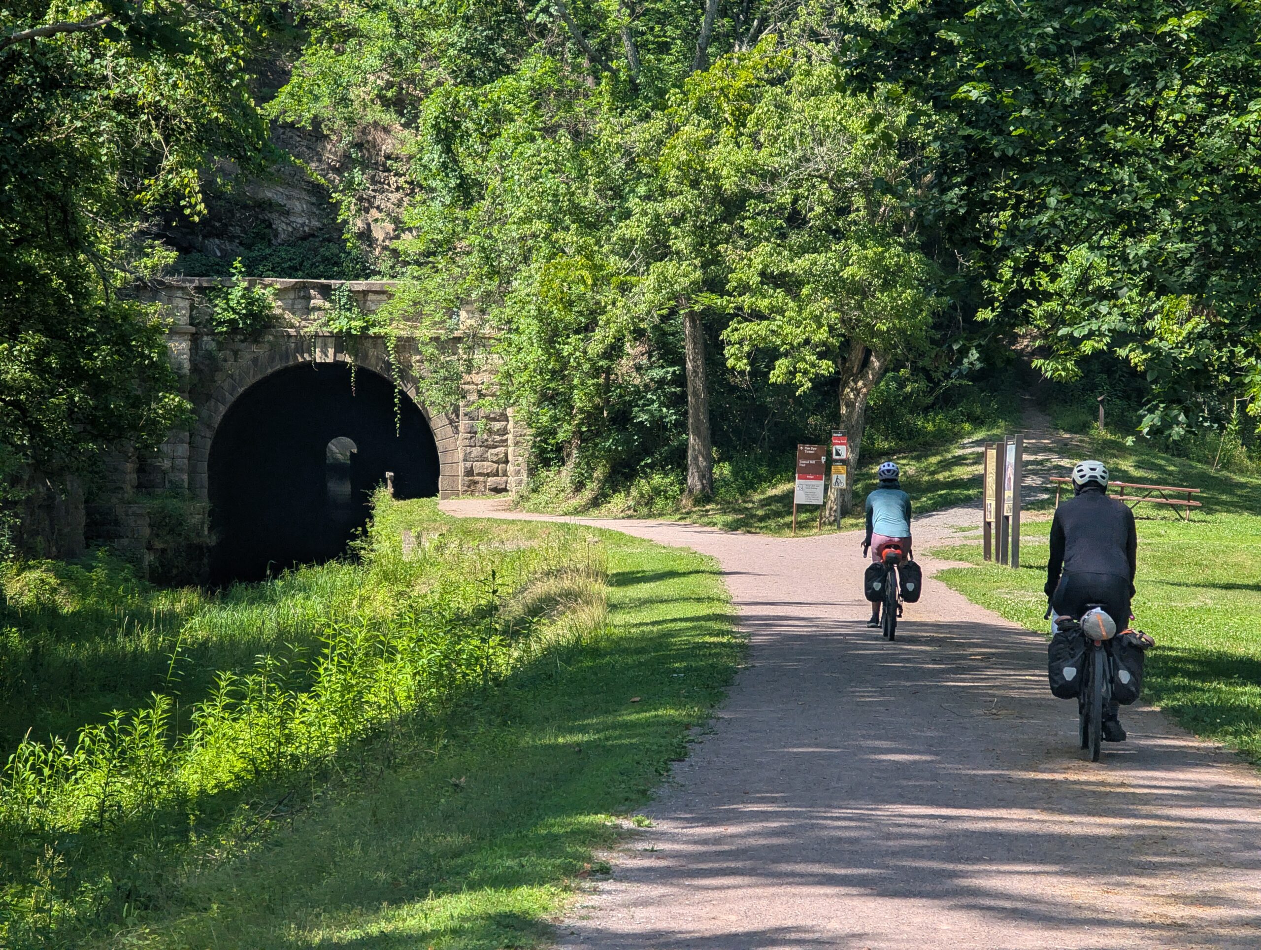
Amy hit the brakes a little too late, sending her sunglasses flying into the abyss on first contact with the warped pavement. She attempted to ride again, but gave up after falling hard against the wall of the tunnel, then just walked the rest of the way. Tyler did not have his bike light handy, so he followed mine as we carefully pedalled over a mine field of deep puddles. After what seemed like ten minutes, the three of us emerged on the other side. What the hell was that?

Even after clearing the tunnel, the terrain did not revert to the smooth, gravel of which we were accustomed. What followed was approximately ten miles of two-way single track over rooty dirt. I was worried that the remainder of the C&O would be similar terrain, but fortunately it transitioned to a smooth, almost clay-like path before reaching the town of Little Orleans.
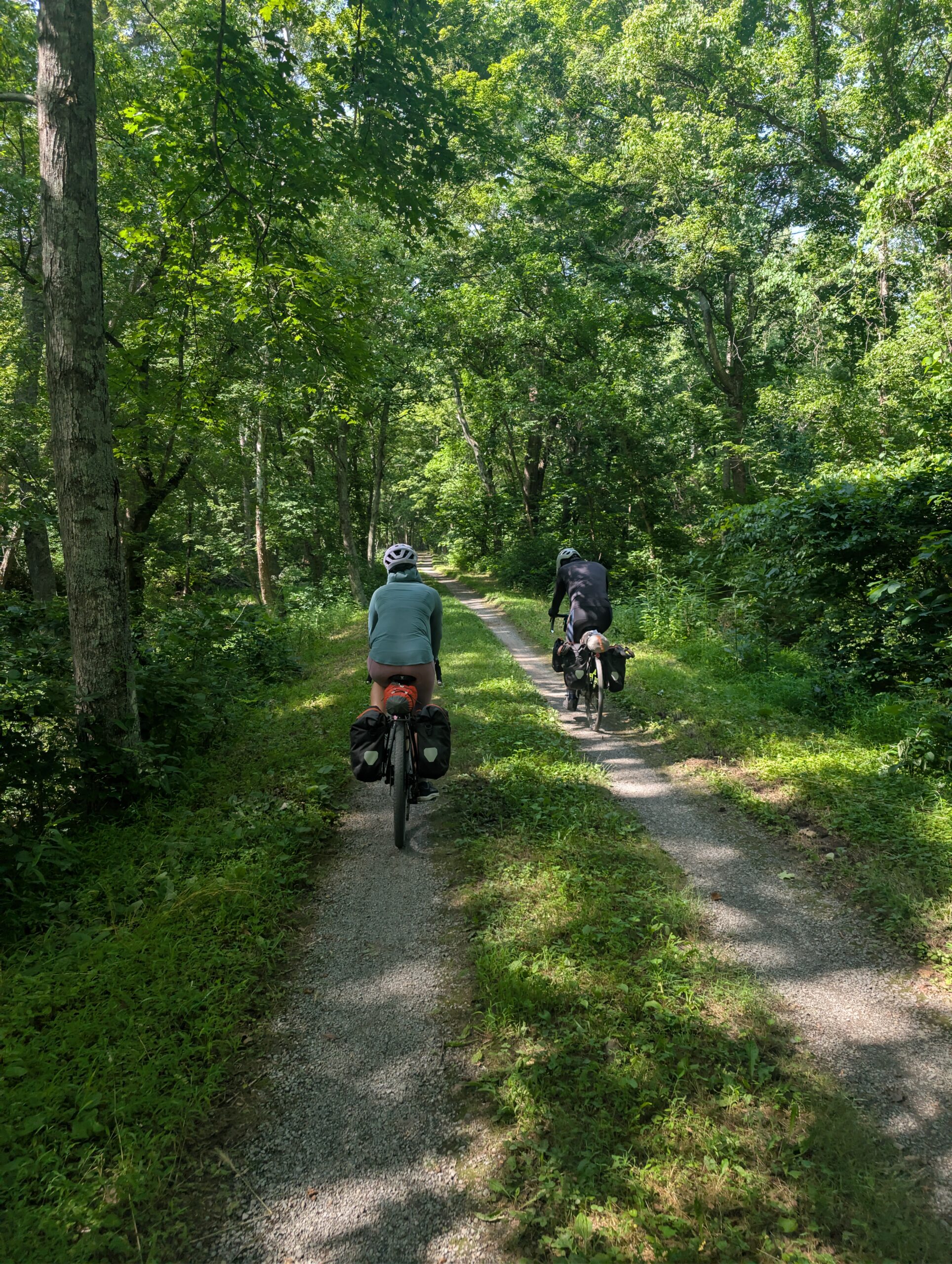
Bill’s Place was really the only thing going on in Little Orleans. This place was a real biker bar (and I do not mean bicycles) with a menu consisting of only food that could be found in the freezer aisle at Walmart. They did not seem to have running water and the air-conditioning was lackluster. Despite all of this, we left feeling completely rejuvenated.

We checked the weather and discovered, to our horror, that the low for the night was 85 degrees. Our original plan to camp sounded miserable and we decided to push even further ahead to find a hotel for the night. On the way, we saw paramedics loading somebody on trail into an ambulance (no doubt heat-related).

We met two guys, “red shirt” and “grey shirt”, and followed them for the final ten miles of the day. Red shirt had done a trans-America bike ride back in the day, while Grey shirt was new to touring.
Parallel and literally only a few yards from the C&O was the recently constructed, Western Maryland Rail Trail. The pavement was pristine and the difference in rolling resistance was night and day. With less effort, we could easily move 3-4mph faster. For a short stretch, this was the official towpath detour, but we chose to follow the WMRT for as long as we possibly could.
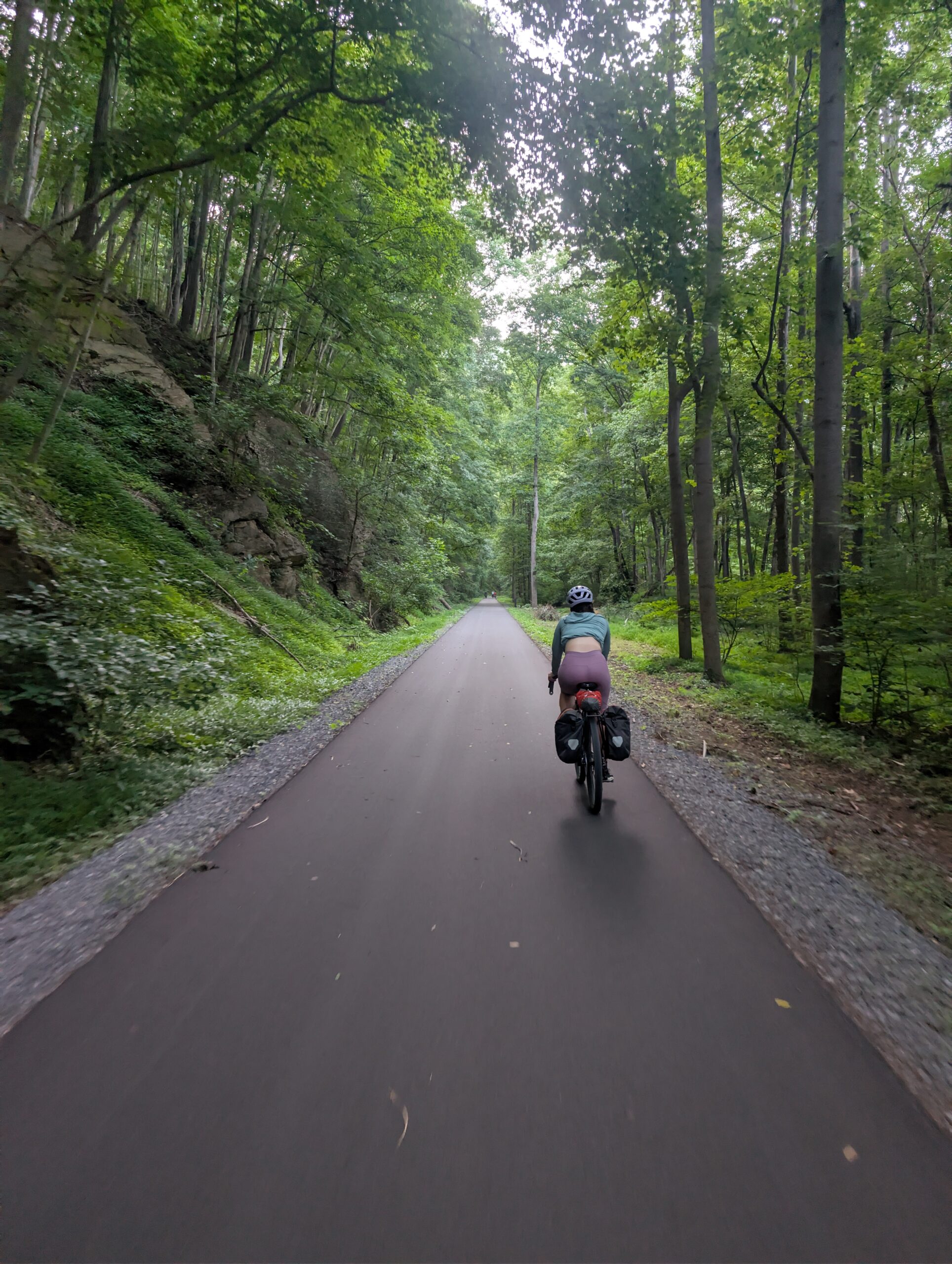
We eventually made it to the town of Hancock, MD, home of the world-famous Super 8 Motel with air-conditioned bedrooms for only $80/night. The frat bros were hanging around in the parking lot and offered us congratulatory beers as we rolled up. We talked and drank with them for a while before calling it a night.
7/3 – Day 5
74 miles from Hancock to Harper’s Ferry (Cross Trails Hostel)
My first thought when I woke up in the morning was, “I wish today was the last day.” We were ahead of schedule, but still had a minimum of two full days of biking remaining. I was having a great time, but it was growing more and more difficult with every mile. We were now tackling longer distances, my quads were sore, and the pain in my ass was becoming severe. Everytime a stranger saw us biking, they commented that it is too hot for us to be doing such a thing. I agreed with them.
We went to the Potomac River Grill and then Sheetz for breakfast and snacks. I applied a half bottle of sunscreen and a half packet of Chamois cream, then we got moving for the day. Fortunately, the first ten miles were along the paved rail trail and we got off to a strong start.
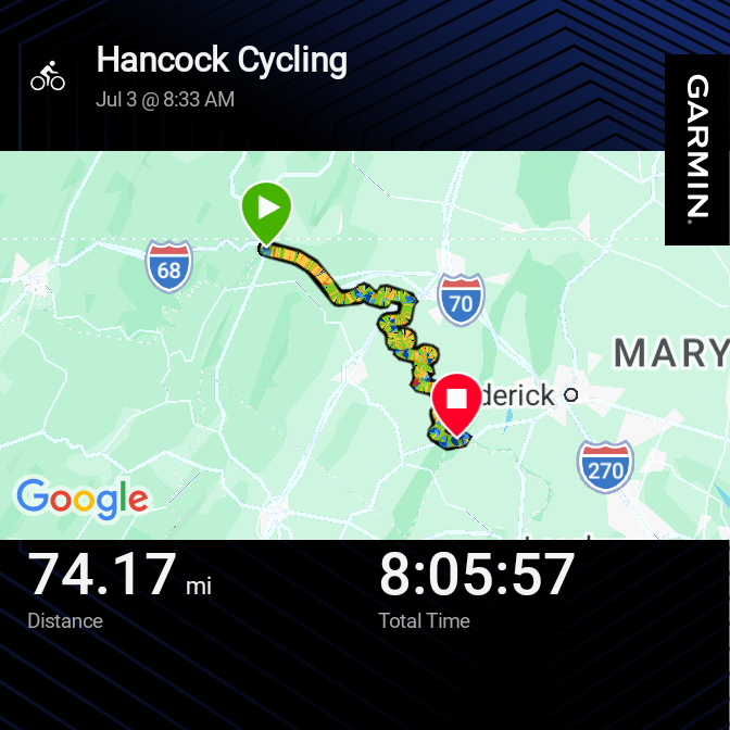

Upon rejoining the towpath, we were blessed by a green tunnel over crushed limestone. However, shortly afterwards we came across consecutive obstacles: a downed tree blocking the trail, followed by a detour that required us to walk our bikes up a staircase.

After a solid twenty miles were logged for the day, we reached the town of Williamsport. Amy and I voted we return to Sheetz for lunch, since their air-conditioning was seriously powerful. Honestly, there was not much else notable about this town, it was kind of boring. Though Tyler said I probably felt that way because we just went to a gas station and left.

The next stretch was one of the most scenic of the entire towpath. A couple miles of trail were carved out of the cliffs overlooking the Potomac. Boats were full of families enjoying their 4th of July weekend, splashing around in the river. Shortly after, we passed a low-key marker engraved “midpoint”.

Rather than cross the river into Shepardstown at the next bridge, we pedaled a short hill to Potomac Ridge Brewery. This location was just shy of Sharpsburg, the famous site of the civil war battle of Antietam. It would have been neat to explore the history, but it was a bit too far away. The brewery proved to be a wonderful spot; both the food and beer we ordered were delicious. We took a longer than usual break to imbibe and allow the sun ample time to make it descent. When we left at 6:00pm, it was not any cooler but the trees now blocked the angled rays of the sun, which made a huge difference.

Wildlife on the towpath was abundant (notably more than the GAP). I nearly ran over a second cuddly rodent, this time a squirrel, and then dodged a box turtle taking his time across the gravel.

As we continued east, the mountains surrounding the river grew ever so slightly more dramatic. We reached Harper’s Ferry, which was an intersection point with the Appalachian Trail. The bridge to reach town was difficult to access. We had to individually haul our bikes up a staircase.

In town, there was not much going on late in the day, and the hotels were all booked up. We did run into the frat bros again, sitting in a park drinking beer. They seemed to be struggling as much as we were after the scorcher of a day.

We left town immediately after securing bunk beds at the Cross Trails Hostel. The hostel was three miles down the trail on a stretch that was shared between the Appalachian Trail and the C&O Canal Towpath. I distinctly remember hiking the gravel portion of the AT four years ago! While we did not stay at the hostel last time, we did swing by, and I was excited to return.

Cross Trails Hostel is a unique spot, to say the least. For Tyler, this was his first experience with an AT hostel. Tents were scattered among the front yard, the kitchen area was a trail magic mess, and the bunk room had a putrid, hiker funk. We took much needed showers and did a group load of laundry, and could even wear fresh loaner clothes for the night.

To our surprise, Amy and I actually knew some of the hikers: She-ra, Jackpot, and the owner, Learning Curve. We hung out with them, as well as Blossom, Hot Sauce, and Bill, chatting and playing that hook & ring game for a while. The hostel culture on the AT is one of the greatest parts of a thru-hike and it was nostalgic to return for the night. It really is a whole different world.
7/4 – Day 6
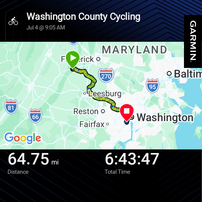
60 miles from Harper’s Ferry to Washington
Hikers kept farting the entire night. One guy in particular ripped so loudly that he woke himself up. Disgusting! Despite the noxious gas, I slept decently well and woke up ready to knock out the final stretch of the trail. We were ahead of schedule and poised to reach Washington by the end of the day on July 4th.
It was also much cooler outside: a crisp 99 degrees. We enjoyed our few hours of somewhat reasonable temperatures before making it to the town of Brunswick, MD. Here, we ate breakfast at Celeste and managed to book a last-minute hotel near D.C. for the less than $400 (it took hours of research).

The challenges today were a lack of towns and fewer campsites than usual. This meant there were places to cool off and dunk our heads under the pumps. The heat was nothing short of oppressive. The trail felt monotonous and I was ready to be done, but the miles ticked away slowly.
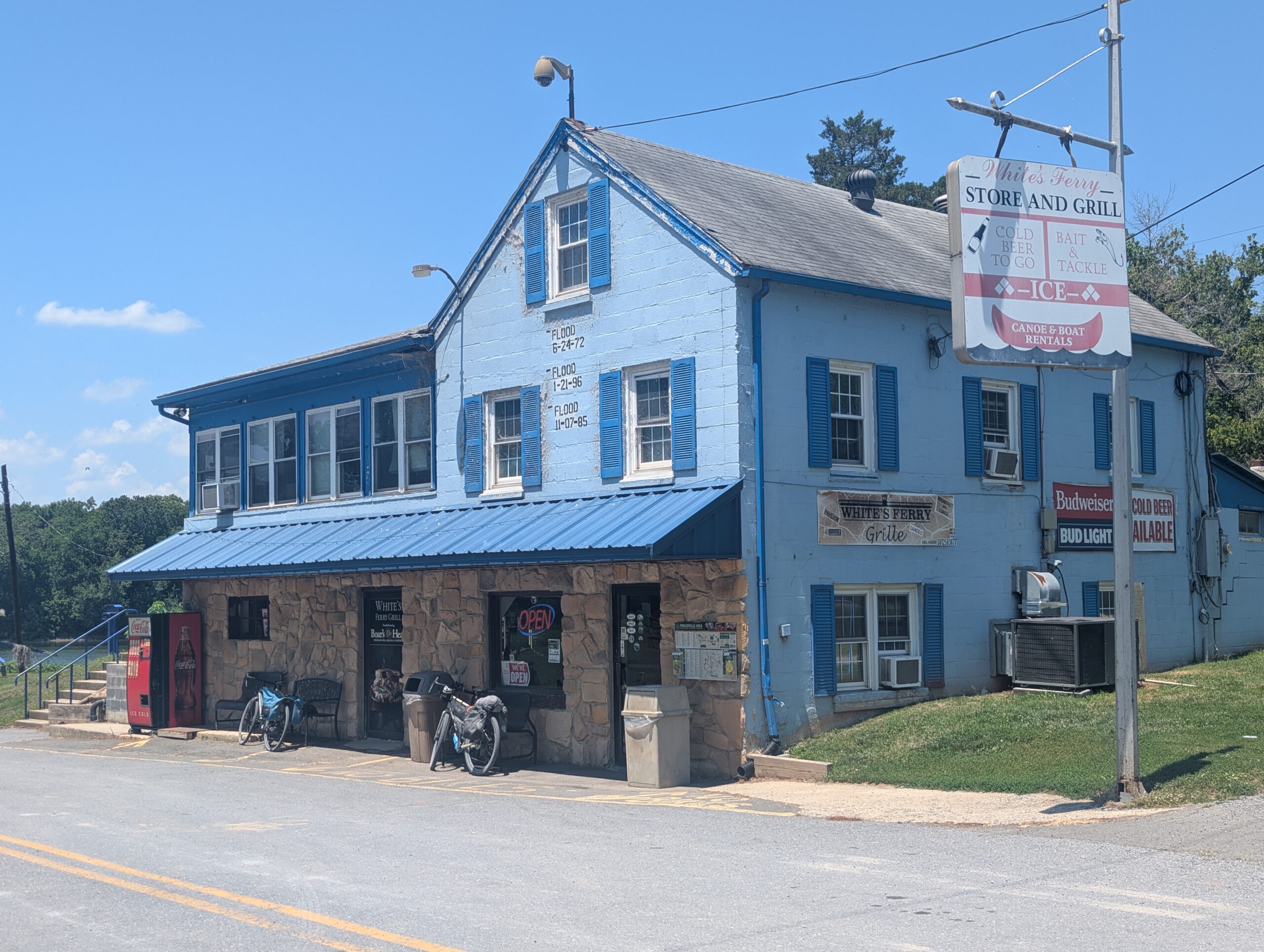
White’s Ferry was our saving grace, which we reached roughly 30 miles into our ride. This is the last operating cable ferry on the Potomac River. On the shore was a small store and cafe with food that punched well above its weight class. Our friends grey shirt and red shirt were there too.
After another hour, we reached Great Falls Tavern. This is a historic building that operated as a hotel for folks travelling the towpath. More impressive than the visitor center was the rugged scenery of the park. Waterfalls cascaded through the rocks of the Potomac. The next several miles through Great Falls Park were the most beautiful of either trail, in my opinion.

We spied dozens of herons and deer along the canal. On the other side, the rocks eventually vanished and the river grew extremely wide as we neared Washington and its eventual estuary. What I found surprising was that even just a few miles out of the capitol, there was still not a trace of urbanism. Whereas it is obvious when GAP reaches the industrial neighborhoods of Pittsburgh, the C&O Canal Towpath is tucked away in a secluded greenway.


Admittedly, I was struggling with the heat towards the end of our ride. Even with less than five miles remaining, I had to stop multiple times to cool off. Stopping did not really help though, as it meant forfeiting a breeze to sit idle in a sauna instead. I powered through, even as the trail grew bumpier every mile closer to the city.
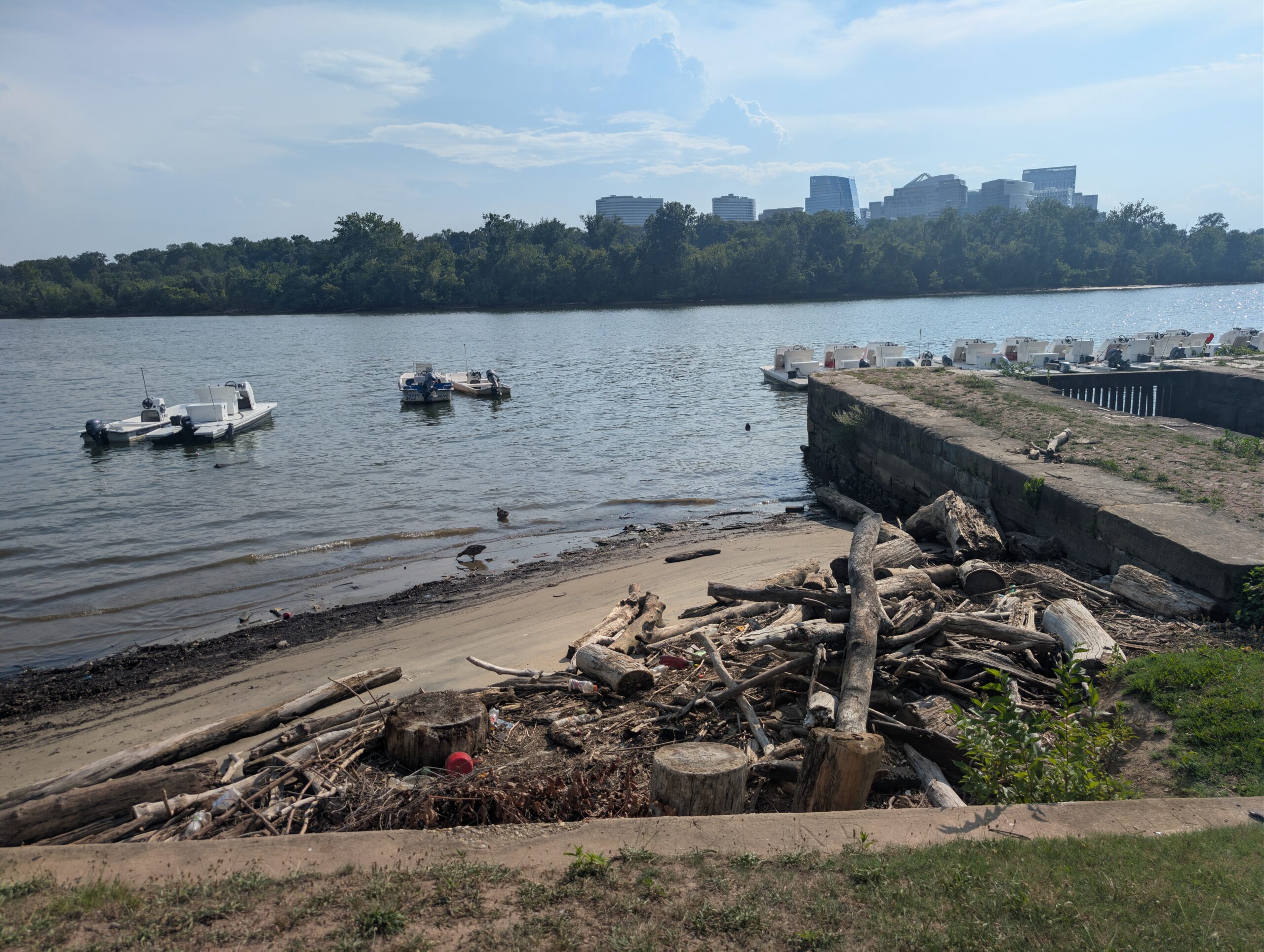
Eventually, we entered Georgetown and turned away from the canal down an urban street. We followed bike lanes for a few miles and navigated to terminus of the trail. Apparently forgotten, Mile 0 of the C&O Canal Towpath was a simple concrete pillar shoved behind a boat center. The shore was only partially covered in trash. However that did not matter, we had made it to Washington and completed the 334 mile grind!

Less of a celebration and more of a collective, “we need to get inside as soon as possible or we will pass out of heat exhaustion”, we went straight to a bar called Mr. Smith’s. After ordering several rounds of water, the bartender asked with a certain tone, “anything else?” and I was obligated to share a beer with Tyler and Amy.
Our final order of business was to bike to our hotel in Arlington, VA. It was only four miles away, but entirely uphill. The route was fairly safe with decent bike lane access. We arrived at the Days Inn before 7:00pm and had plenty of time to clean up and eat dinner at Bangkok 54.

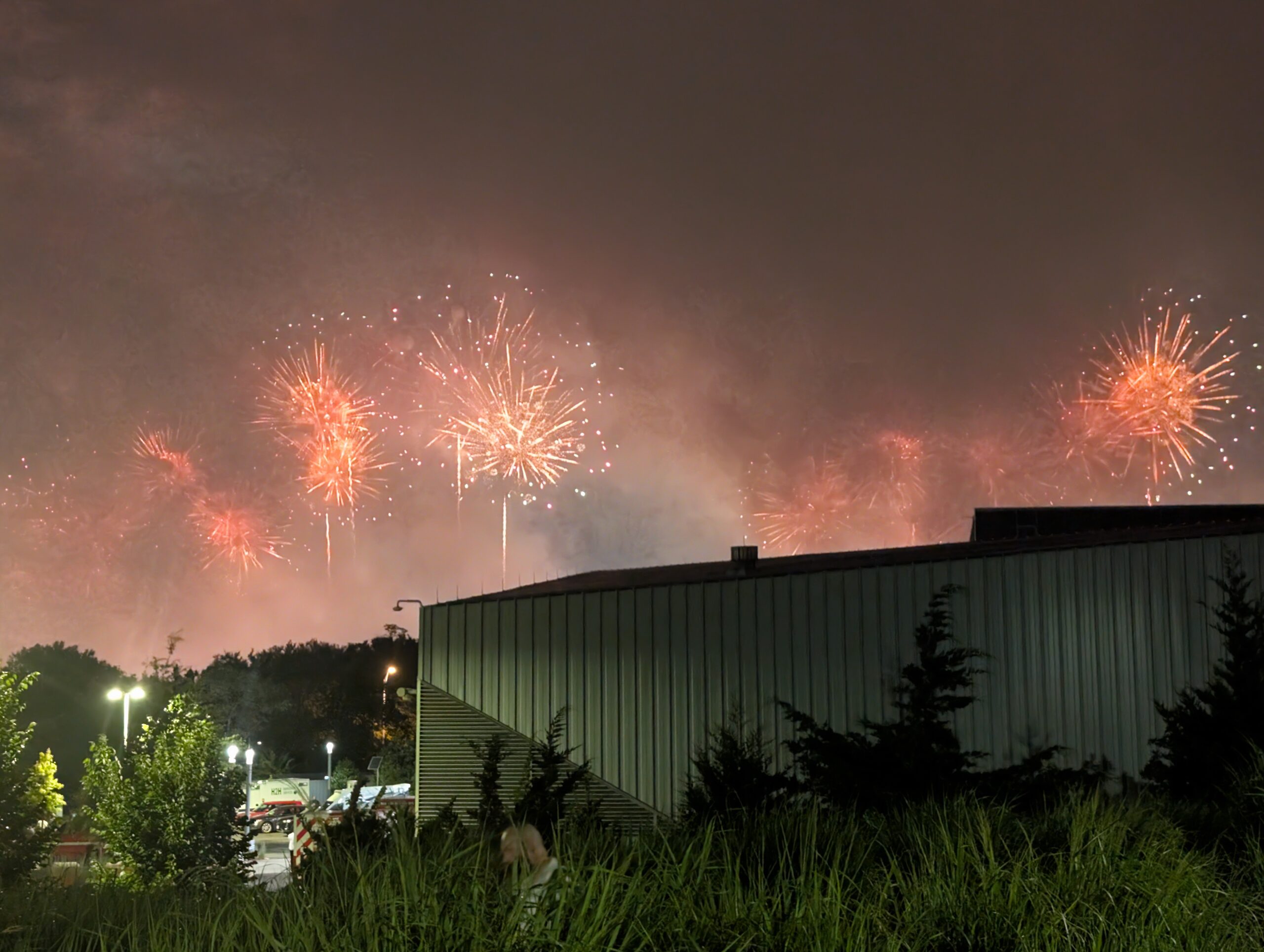
The buzz around town was “America 250”. A record-breaking firework show was scheduled at 10:30pm. We attempted to Uber down to Gravelly Point along the river, but road closures made it quite the adventure. Eventually, we made it to Long Bridge Park and claimed a bench. The show was delayed due to weather (even though it was not raining), then Trump determined the show should not begin until after he makes a speech. His dementia rant lasted over an hour. Families with children were leaving the park. Bikers who rode from Pittsburgh were about to fall asleep. At midnight on July 5th, the show began with a massive barrage of fireworks. So many were released at once, in fact, that the smoke from the first few explosions obscured the sky for the remainder of the performance. It was pretty lame, so we left shortly afterwards. The bad weather finally arrived as we tried to hail an uber. It took another 30 minutes of walking through the downpour to secure a ride. We made it back to the hotel at 1:40am.
7/5 and 7/6
0 Miles in Washington, DC
We planned an additional day and a half after our bike trip ended for sightseeing and additional buffer time. Unfortunately, Tyler had to take an earlier train home due to a cancellation, so we only had a few hours in the morning. We were able to at least see the Air Force Memorial in Arlington before hopping on the metro with our bikes to reach Union Station.

After saying goodbye to Tyler, Amy and I went to the Smithsonian Museum of American History, rode Lime scooters across the National Mall to the Lincoln Memorial, and saw the green, algae-infested reflecting pool under repair.

We also stopped by the “Great American Fair”, another part of America 250 that was laughably disorganized. There was little to do and not many people attending. The whole event made a mess of the National Mall. We stayed at the Phoenix Park Hotel, which was an excellent choice, right across the street from the train station. The attached bar, The Dubliner, was a fun spot to spend the evening. The live Irish musician was happy to play “Rattlin’ Bog” twice for Amy, and we took Jameson shots with a guy who used to work in Lawrenceville.

On the final day, Amy and I went to the Smithsonian Air and Space Museum and saw some incredible exhibits on the Wright brothers and the lunar landing. We also booked free guided tours of the US Capitol and got to see the inside of the rotunda, as well as learn about the interesting process of the state-donated statues housed there. I did not expect much of this tour, but it turned out to be the highlight of our time in Washington.

Final Thoughts
This was my first ever overnight cycling trip! Overall, I think it was a fun and challenging experience. It is difficult to separate the physical challenge from the heat, but I would say that completing the ride was harder than expected. We did not have nearly as much leisure time as I thought we would, and it felt like a grind from start to finish.
Compared to backpacking, I love the freedom that a bicycle enables. Being able to travel 4x the speed of walking opens up so many possibilities for side quests and deeper dives into towns and cities. On the other hand, I felt “chained” to my bike and doing little things like stopping to take a photo or use the bathroom had slightly more friction.
Would I do it again? I would absolutely consider doing just the GAP portion another time, since it is perfect for a long weekend. Combining both trails turned it into a larger adventure that I do not necessarily regret undertaking, but also would have preferred a shorter, more relaxed trip. However, Washington was an ideal ending location since there was so much going on and I am proud to say I made the whole journey.
I am looking forward to riding different trails in the future.
Stay dirty,
Alex